The Red Spider Canyon layout - Page 2 of 6

The canyon is ideally located on the border between Arizona and Utah, an area with a high concentration of so many wonderful characteristics of the American Southwest.

It's the area placed between the Monument Valley and the Cedar Mesa, passing through the Goosenecks State Park. If I had to describe it in a nutshell, I would say: multicolored layers of rocks, incredibly blue skies, the feel of the warm breeze on my skin, the rivers' cold water, the infinite silences, the desert wildlife. Desert comes to life as soon as you join it, while you're standing still until you can see it full of life.
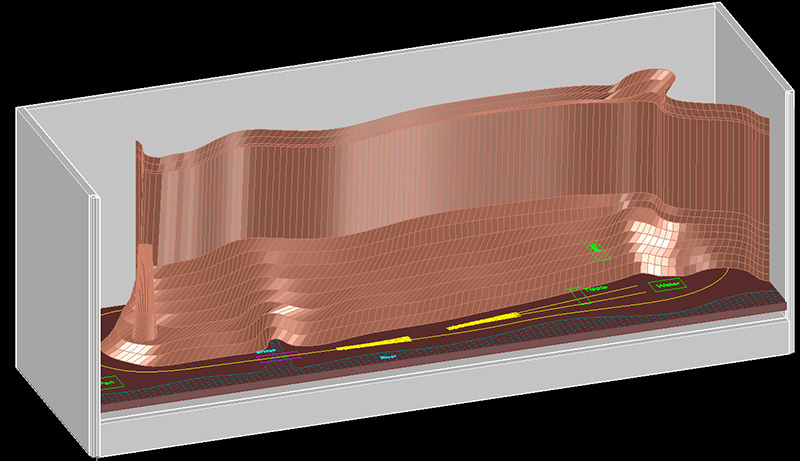
Landscape of these places is simply a huge open book on the geology of our planet, more or less from 240 to 180 million years ago. And so the model tells it: the oldest represented is the Moenkopi formation, which dates back to the Middle Triassic (240 million years ago). On these rocks, nowadays, the Lazy Creek slowly flows, at the bottom of the Red Spider Canyon.

Then, theChinle formations, from late Triassic (210 million years ago), formed by sand accumulations of an ancient inland sea. It forms steep slopes in a typical red/purplish color, covered with debris.
Above these, here it is the Wingate formation (200 million years ago), a sandstone due to accumulations of sand dunes carried by the wind, orange-red and characterized by frequent vertical cracks. Then it comes the Kayenta formation Jurassic, 195 million years ago), with its layers typically jagged edges.
Last represented in the layout, is the Navajo formation, dating in the early Jurassic (between Pliensbachian and Toarcian, between 190 and 175 million years ago). In this layer are formed typically roundish rocks and with the most varied shapes as, for example, typical arches of the Colorado Plateau, and Utah's itself.

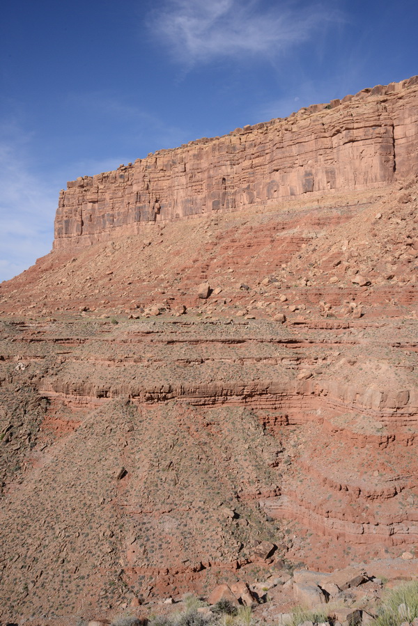
All these rock formations are visible in many parts of the Colorado Plateau area, but it was during my first visit to the North Rim of the San Juan River, heading to the John's Canyon, when I firstly had the idea to reproduce such a landscape in a model layout.
In the picture, in fact, you can see represented all the details that characterize these places and that make this part of the US so wonderful.
So I studied the geography, geology, flora, fauna, but also the history of the people who lived in those remote places.
My layout, in fact, should tell not only one but many stories from the South West, useful for me to remind I was there and for othe people to know those places without having been there before.
This area marks the boundary line between the Arizona's deserts and the mesa above them. A short distance from each other there are so different environments. The first is a typical flat, crossed by deep canyons carved by rivers (San Juan River, Green River, Colorado River), the second is a plateau characterized by a vegetation of medium-height shrubs and flooded streams. Here lived communities of the ancient Anasazi and Pueblans.


